

Route through Parque Rural de Anaga II
Nature, history and traditions
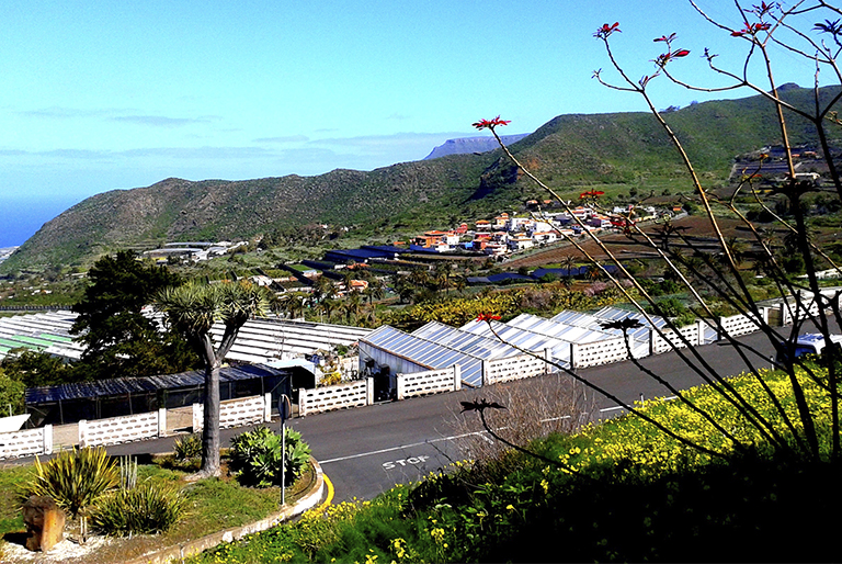
On this route you will discover the northernmost part of the Parque Rural de Anaga. In it you will have the opportunity of discovering old hamlets, admiring spectacular views of the Atlantic Ocean and venturing into the forests, ravines and valleys of the Anaga massif, and experience at first hand the history and traditions of this beautiful little corner of Tenerife.
Other points of interest
ALMÁCIGA Y BENIJO
Almáciga and Benijo are two coastal areas of Anaga next to each other. Easily accessible along the road from El Bailadero to Benijo, they are situated only a few minutes by car from the village of Taganana. These unspoilt spots still retain some plots of traditional crops at the foot of the mountains and offer incomparable views of the Atlantic coast. The black sand beaches here, situated at the foot of high cliffs and the Roques de Anaga standing out at sea, present a quite unique, incomparable panorama.
Adresse: Carretera de El Bailadero a Benijo (Por Taganana), TF-134
PICO DEL INGLÉS VIEWPOINT
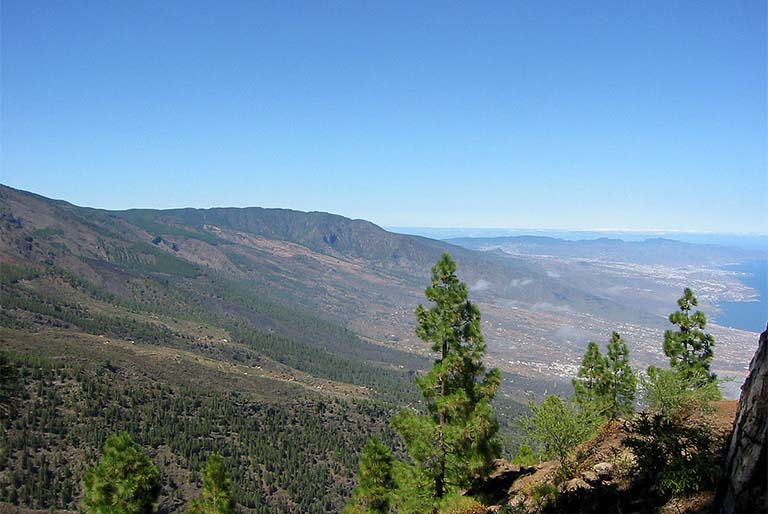
The Pico del Inglés Viewpoint, set in green surroundings, offers a spectacular vista of the heart of the Anaga massif. From here you can contemplate the Roques de Anaga, the mountain ridges striding across the Park, the towns of Santa Cruz de Tenerife and La Laguna and even, on clear days, the neighbouring Island of Gran Canaria.
Adresse: Carretera de acceso al Mirador de Pico del Inglés, TF-114.
LA CRUZ DEL CARMEN
At La Cruz del Carmen you are able to visit the Visitor Centre which houses an exhibition explaining the most significant features of the Parque Rural de Anaga, and emphasising its natural wealth and ethnographic aspects; there is a viewpoint from which to take in the panoramic views of the La Laguna lowlands and as a backdrop on clear days, Mt. Teide; here, too starts the footpath Sendero de los Sentidos which departs from La Cruz del Carmen and takes you to the Llano de Loros Viewpoint. This path allows you to see Anaga in a very different, special manner. The path is only short, is graded of low difficulty, except for a few step sections, and offers three differing itineraries.
Adresse: Carretera Monte de las Mercedes, km. 6. San Cristóbal de La Laguna
Tel:922 633 576
Stop points
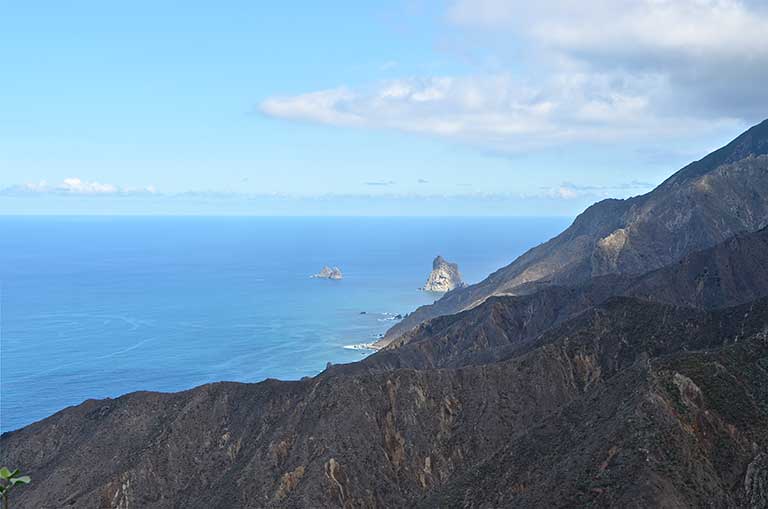
From the Amogoje Viewpoint you can contemplate the exceptional views of the Atlantic coast, of the valley of Taganana and of the rocky islets of Anaga.
The islets form part of the Roques de Anaga Nature Reserve. This nature site is formed by two rocks, the Roque de Tierra (landward rock), the larger of the two nearest to the coast, and the Roque de Fuera (outer rock). Their original shapes and their location, emerging as they do from the Atlantic, have made them a symbol of the Island.
This corner of Anaga, besides, is characterised by the singular lie of the land, formed by mountains with impossible contours, plunging valleys and craggy cliffs that paint a unique scenery of a beauty difficult to describe.


