

Route Adeje and Guía de Isora
For traditional Southern corner
Presentation
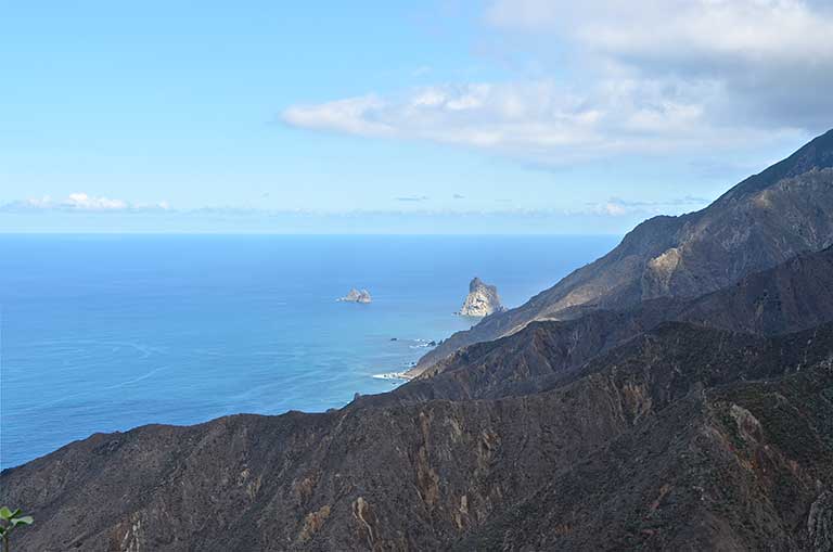
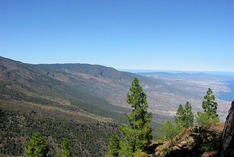
The route from Adeje to Guía de Isora takes you on a trip to discover a part of the Island full of small, isolated hamlets, where the essence of the Island’s rural world has remained, as if it were unalterable. These are scattered villages, dispersed among ravines, valleys and mountains, where the isolation has had an impact on maintaining many of the traditions followed by small farmers and which are characteristic of Canarian culture. These widely-spaced villages are places surprising in their contrasting scenery, with volcanic areas shaped by badlands and lava flows, the consequence of different eruptions, natural monuments such as Tejina Mountain, abrupt ravines like those of Erques and Tágara. Farming and raising livestock have been a fundamental part of the economy of these small towns, although over the last few decades an important tourist sector has developed, especially in coastal areas. Although the villages came into being in the course of the XVIth century, the different archaeological finds have shown that these territories which were part of the aboriginal kingdom of Adeje (or Adexe) were home to the aboriginal inhabitants, and in the area there were settlements and areas devoted to pasturage. After the Conquest and colonisation by the Castilians, crops such as sugar cane and vines came to play a prominent role. The case of Adeje is worth mentioning, where a cane sugar mill was set up. Throughout their history, these lands suffered from the much-feared raids by pirates. These circumstances led Pedro de Ponte y Vergara, founder of the entailed Estate of Adeje, to appeal to the authorities to build what became known as the fort house of Adeje, with the aim of creating a defence against these repeated attacks. Adeje and Guía de Isora preserve a rich cultural and natural heritage with a multitude of contrasts and highly original landscapes, of a beauty both unexpected and breathtaking. The wealth of their history is combined with elements original to the agrarian culture of the Island. Hamlets such as Aripe and Chirche allow the visitor to see magnificent specimens of ordinary people’s dwellings and rural buildings such as threshing yards, ovens, cisterns, etc. of great heritage value, and give us a glimpse of the ways in which natural resources were traditionally used in the area. Life in these rural areas seems to pass quietly, holding onto the accumulated expertise of bygone times, yet incorporating aspects more appropriate to the modern age. Many of the ancient plots continue to be cultivated following the old methods; recent buildings try to respect the features of typical, traditional buildings and place special emphasis on keeping those specific features that define their rural identity.
Places of interest
IFONCHE
Location: Main road La Escalona-Ifonche, TF-567, km 3
CHÍO RECREATIONAL AREA
Location: Main Road Chío-Las Cañadas (Road Boca Tauce), km 12.5
Route points
/
{"playlist":[{"title":"TAUCHO","artist_name":"","audio_file":"https:\/\/rutasteneriferural.com\/wp-content\/uploads\/2022\/09\/1-taucho_zInD.mp3","poster_image":"https:\/\/rutasteneriferural.com\/wp-content\/uploads\/2022\/08\/0taucho1_aleman-1-1208x800.jpg","duration":"1:38","playlistid":"playlistid-1"}]}
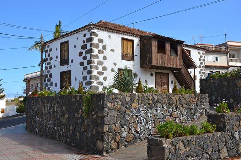
The picturesque village of Taucho is situated in the middle slopes of Adeje and reveals examples of rural architecture of the southern part of the Island and something of its history and the culture of its inhabitants. These places were zones of pasture in pre-hispanic times; the caves in the nearby ravines were possibly the sites of aboriginal settlements. After the Conquest of the island, the land and water were distributed among the conquerors. Whilst the territory of Adeje became the property of Pedro de Ponte y Vergara, Taucho, according to what researchers have been able to discover, came under the aegis of the Mena family. The farmers who cultivated these lands represent the beginnings of the village as such. From its earliest beginnings as a settlement, the village was devoted to agriculture, with its houses along with other buildings such as bread ovens, threshing-floors, etc., representing the result of the daily life of the peasant communities who inhabited it and as a response to their immediate needs. The remains of the elements inherited from the past that can be seen in Taucho reflect those peasant lifestyles that seem to have survived until the present day. Taucho is made up of small groups of houses, the oldest being built using traditional techniques, with local materials, allowing them to blend in with the landscape. In the oldest buildings the most notable feature is the use of stone, wood and tiles. Next to the dwellings, kilns for tiles and bread ovens are commonly seen, with a circular shape, formed of two sections and open at the top. To get to know Taucho, it is best to make a tour on foot, stopping to contemplate the simplicity of the houses, enjoying the panoramic views that can be seen from the church square and discover little paths dotted with small ovens or terraced plots, still cultivated today.

/
{"playlist":[{"title":"TOWN CENTRE OF GU\u00cdA DE ISORA","artist_name":"","audio_file":"https:\/\/rutasteneriferural.com\/wp-content\/uploads\/2022\/09\/2-guia_C2Ki.mp3","poster_image":"https:\/\/rutasteneriferural.com\/wp-content\/uploads\/2022\/08\/0guia1_rQGC-1208x800.jpg","duration":"1:01","playlistid":"playlistid-2"}]}
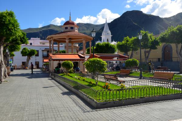
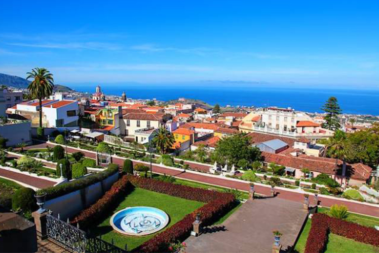
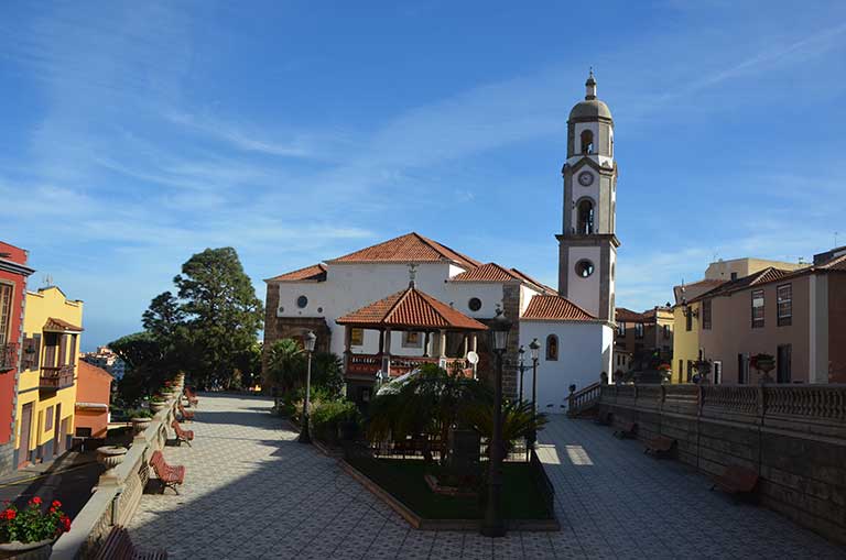
The small town of Guía de Isora is the nucleus of the municipality of the same name. Situated in the middle slopes, some 580 metres above sea-level, it offers an exceptional view of the coast of the municipality and of the higher elevations. Its streets and squares are the ideal place to relax and enjoy the tranquillity of the town. The town has its roots in the XVIth century with the discovery of the Virgen de La Luz and the subsequent construction of the church. The first settlement grew up around the shrine and as time passed turned into the picturesque village of Guía. Worthy of mention is the original layout along two main streets, the Upper Street (Arriba) and Lower Street (Abajo), which were part of the old Camino Real ("Royal Highway" - a network of bridle paths financed by the Crown). Its historical centre, declared a Site of Cultural Interest in 2009, retains many architectural elements that are worth visiting. Strolling through the streets brings us closer to their history and culture, as you discover civil and religious buildings, examples of periods of splendour, a result of the money sent back to the inhabitants by residents who emigrated to "The Americas" during the XIXth century.

/
{"playlist":[{"title":"HAMLET OF ARIPE AND CHIRCHE","artist_name":"","audio_file":"https:\/\/rutasteneriferural.com\/wp-content\/uploads\/2022\/09\/3-chirche-y-aripe_KMJH.mp3","poster_image":"https:\/\/rutasteneriferural.com\/wp-content\/uploads\/2022\/08\/0chirche1_5rrN-1208x800.jpg","duration":"1:41","playlistid":"playlistid-3"}]}
The hamlets of Chirche and Aripe are situated in the upper zone of the middle slopes of Guía de Isora and are a storehouse of much of the rural nature of southern Tenerife. Located between ravines, they exhibit an unusual scenic beauty, characterized by areas of pine forest and badlands, memories of their volcanic origin. Chirche and Aripe are separated by less than 1 km, about 5 minutes from the centre of Guía de Isora. We recommend seeing Aripe first and then going to Chirche and enjoying the beautiful views that can be seen along the whole of the route. The neighbouring Island of La Gomera, the sea and the middle slopes will accompany you on the trip. These hamlets preserve remarkable examples of traditional Canarian architecture and part of the original urban layout, composed mainly of former farm tracks. It is worth stopping and enjoying the peacefulness of their streets and squares and walking the footpaths, whilst discovering part of the Island's rural history. Special mention should be made of some small streets, recently restored, following traditional building techniques with the utmost respect. The homes comply with the typical, local types of construction, featuring thick walls made of clay and small stones, with a single or double or four-pitched roof. From the nineteenth century roofs became generally flat, better adapted to environments with low rainfall. The houses are generally accompanied by numerous constructions such as water tanks, , threshing-floors, bread ovens and tile kilns, places for sun-drying fruit, etc., that constitute outstanding examples of the Island's rural heritage. It is possible to wander all around these areas, enjoying many pleasant walks. The "La Campana" footpath linking Aripe and Chirche is worthy of mention. This is a short path, it is barely over one kilometre long, but is of great interest from the scenic and ethnographic point of view. Along it you can see different elements of traditional agriculture and everyday life of the common man, like tile kilns and threshing-floors. Right at the entrance to Chirche, at the old water spouts, on the right, you will find a panel with a detailed explanation of the footpaths in the area. Here we should mention the existence of aboriginal remains, the most important being the rock carvings to be found in the vicinity of Aripe. As you see, the area was inhabited from pre-hispanic times, although the origin of these villages dates from the second half of the XVIIth century. The basis of their economy has been livestock and agriculture reflected in the vegetable plots, nateros**, threshing-floors, etc., still in existence in the area, and the Almond Fair in Aripe, held every year in late October, and which allows visitors to learn more about the traditional almond harvest. The visit is rounded off with the opportunity to make a small detour in Aripe to go to the church of San Pedro, located alongside the ancient road connecting the village with the neighbouring hamlet of Chiguergue. The church square next to the church itself is a unique vantage point from which to contemplate the beauty of the natural environment surrounding these villages and make the most of the panoramic views of the town and its coastline. **natero: natero is the name given to a system of using for agricultural purposes the run-off water which flows down the hillsides or ravines and is diverted to the cultivated plots or terraces to increase irrigation and raise the fertility of the soil as a result of the accumulated sediment that is washed down.

/
{"playlist":[{"title":"CHIRCHE VIEWPOINT","artist_name":"","audio_file":"https:\/\/rutasteneriferural.com\/wp-content\/uploads\/2022\/09\/4-mirador_jWIb.mp3","poster_image":"https:\/\/rutasteneriferural.com\/wp-content\/uploads\/2022\/08\/0mirador1_rA1q-1208x800.jpg","duration":"0:25","playlistid":"playlistid-4"}]}
Located in a privileged spot in the upper area of the village of Chirche, this viewpoint allows you to discover breathtaking landscapes which leave no-one indifferent. The panoramic views from Chirche and Aripe as well as the upper area of the village of Guía and its coastline, reveal a place of extraordinary beauty. From here you can see exceptional views of the neighbouring island of La Gomera, the different ravines that carve the landscape and the crater of the Pico Viejo [Old Peak]. The viewpoint cafe together with a souvenir shop are worth a visit.

/
{"playlist":[{"title":"CHIO","artist_name":"","audio_file":"https:\/\/rutasteneriferural.com\/wp-content\/uploads\/2022\/09\/5-chio_HexN.mp3","poster_image":"https:\/\/rutasteneriferural.com\/wp-content\/uploads\/2022\/08\/0chio1_F9c0-1208x800.jpg","duration":"0:45","playlistid":"playlistid-5"}]}
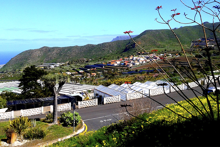
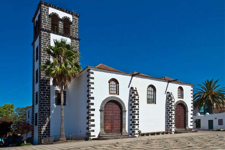
The main centre of Chío, in the middle slopes of Guía de Isora, embraces the beauty of the small villages of Tenerife, a halfway house between the present urban centres and the tranquillity of rural communities. It has a well-defined old town, centred around the church square in the Streets named La Palma, San Juan, Évora Franquis, La Sabina and El Atajo. The beginnings of Chío as a village date back to the XVIth century. However, the archaeological remains found here confirm the existence of aboriginal settlements prior to that. At some time during the XVIIth century a small chapel was built, but population growth made it insufficient to meet the religious needs of the residents. Accordingly it was demolished and the construction of the present church of San Juan Bautista de Chio was undertaken, on a larger scale. Around the square, buildings with typical rural characteristics can be found, which show fine examples of domestic architecture. Another element inherited from the past located in Chío, also in the historical town centre, are the old public water spouts. Piped water reached Chío in 1902 thanks to the efforts of one of the residents, Joseph Évora Franquis. A memorial plaque next to the water spouts pays tribute to him.


